U O Z

Loading

Remote Sensing and Geographic Information Systems (GIS) Center

Education & Training

GIS Certification Track Syllabus

Structured professional education designed to equip local youth, university students, and government officials with marketable geospatial and Earth observation skills.

Level 1: Fundamentals of GIS & Cartography

  • Spatial Data Models: Understanding vector (points, lines, polygons) and raster data structures.
  • Coordinate Systems: Map projections, datum transformations, and spatial referencing.
  • Data Management: Geodatabase creation, topological rules, and field data integration.
  • Cartographic Design: Thematic mapping, symbology, and producing publication-quality maps.

Level 2: Applied Satellite Remote Sensing

  • Earth Observation Principles: Multispectral imagery interpretation and sensor characteristics.
  • Image Pre-processing: Radiometric, atmospheric, and geometric corrections.
  • Spectral Indices: Calculating and analyzing NDVI, NBR, and NDWI for environmental monitoring.
  • Classification Algorithms: Implementing supervised and unsupervised image classification techniques.

Level 3: Advanced Spatial Data Science & ML
  • Cloud Computing: Processing large-scale satellite data using Google Earth Engine (GEE).
  • Spatial Automation: Scripting geospatial workflows using Python (GeoPandas, Rasterio).
  • Predictive Modeling: Applying machine learning algorithms (Random Forest, XGBoost) to spatial datasets.
  • Deep Learning Applications: Utilizing CNNs and DNNs for complex land use and forest cover dynamics.

Field-First Learning

Training Beyond the Classroom

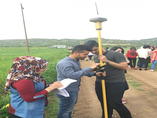
Every certification level pairs lab sessions with real fieldwork. Trainees collect GNSS measurements with Topcon rovers, ground-truth satellite classifications, and build portfolio-ready projects using data from the Kurdistan Region.


Photo: GNSS field exercise led by the Center